Skip to main content
Facebook
Twitter
LinkedIn
Instagram
Youtube
Home
Who We Are
About Us
Vacancies/Internships
Partners/Donors
What We Do
Focal Areas
Projects
Where we work
What We Have for You
Products & Services
Information System
Groundwater Catalogue
Videos
Downloads
What is Groundwater?
Groundwater Basics
Stories
Groundwater Glossary
News & Events
News
Events
Newsletters
Menu
Search
Downloads
Brochures & Flyers
Image
Advances in transboundary cooperation in the Senegalo-Mauritanian aquifer basin (SMAB)
Read more
Download pdf (3.5 MB)
Image
WMO data conference: Earth system data exchange in the 21st century
Read more
Download pdf (1.04 MB)
Image
Groundwater - Critical for Sustainable Development
Read more
Download pdf (5.63 MB)
RAMOTSWA Information Management System (RIMS)
Read more
Download pdf (4.07 MB)
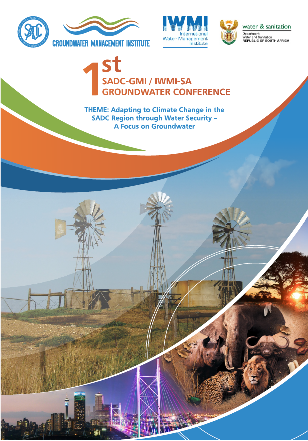
1st SADC-GMI Groundwater Conference 2018
Read more
Download PNG (795.98 KB)
Image
SADC-GIP: SADC Groundwater Information Portal
Read more
Download pdf (6.67 MB)
Regional Groundwater Mapping: A strategic tool for climate change adaptation
Read more
Download pdf (1.94 MB)
Governance of Groundwater Resources in Transboundary Aquifers (GGRETA) project SPANISH
Read more
Download pdf (1.54 MB)
Governance of Groundwater Resources in Transboundary Aquifers (GGRETA) project
Read more
Download pdf (1.35 MB)
GGRETA Information Management System (IMS)
Read more
Download pdf (656.6 KB)
IGRAC's Managed Aquifer Recharge (MAR) Activities
Read more
Download pdf (6.03 MB)
Global Groundwater Information System (GGIS)
Read more
Download pdf (19.14 MB)
IGRAC Corporate Profile
Read more
Download pdf (2.74 MB)
Brochures & Flyers, Papers
Image
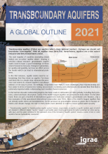
Transboundary aquifers: A global outline 2021
Read more
Download pdf (2.6 MB)
Brochures & Flyers, Maps
SADC Hydrogeological Map - Explanatory Brochure
Read more
Download pdf (5.39 MB)
Maps
Image
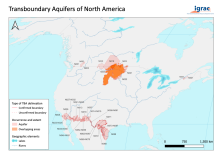
Transboundary aquifers of North America map 2022
Read more
Download pdf (1.43 MB)
Image
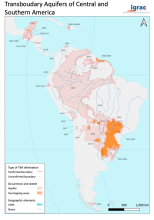
Transboundary aquifers of Central and Southern America map 2022
Read more
Download pdf (1.21 MB)
Image
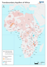
Transboundary aquifers of Africa map 2022
Read more
Download pdf (1.46 MB)
Image
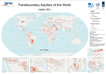
Transboundary Aquifers of the World map 2021
Read more
Download pdf (5.8 MB)
Image
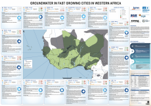
Groundwater in fast growing cities in Western Africa
Read more
Download pdf (5.34 MB)
WHYMAP - Global map of groundwater vulnerability to floods and droughts
Read more
Download pdf (12.92 MB)
Transboundary Aquifers of Latin America Map
Read more
Download pdf (1.26 MB)
Transboundary Aquifers of Africa Map 2016
Read more
Download pdf (1.05 MB)
WHYMAP - River and Groundwater Basins of the World (explanatory notes)
Read more
Download pdf (4.63 MB)
WHYMAP - River and Groundwater Basins of the World
Read more
Download pdf (5.05 MB)
WHYMAP - Groundwater Resources of the World (incl. thematic maps)
Read more
Download pdf (7.96 MB)
WHYMAP - Groundwater Resources of the World (Transboundary Aquifer Systems)
Read more
Download pdf (2.67 MB)
Transboundary Aquifers of the World Map 2015
Read more
Download pdf (8.39 MB)
Home
Who We Are
About Us
Vacancies/Internships
Partners/Donors
UNESCO IHP
WMO
Dutch Government
IAH
What We Do
Focal Areas
Groundwater Assessment
Thematic Assessment
Groundwater Economics
Groundwater and Ecosystems
Groundwater Governance
Groundwater Monitoring
Information & Knowledge Management
MAR
Global inventory of MAR schemes
Training & Capacity Building
Transboundary Groundwaters
Small Island Developing States (SIDS)
Projects
Where we work
What We Have for You
Products & Services
Information System
Global Overview
GGMN
TWAP viewer
MIM
Country and aquifer briefs
Groundwater Catalogue
Videos
Downloads
What is Groundwater?
Groundwater Basics
Stories
Groundwater Glossary
News & Events
News
Events
Newsletters
Past Newsletters


")


 project")
")
 Activities")
")


")

")
")
